Reserve from the case
Shipping Estimate
USA
- USA
- CAN
- USA
- CAN
Ships within 48 hours · Estimated delivery Oct 23 - Oct 28
Reserve from the case
Ships within 48 hours · Estimated delivery Oct 23 - Oct 28
The NOAA Nautical Chart 13200: Georges Bank and Nantucket Shoals is printed on heavy weight acid free paper with the latest Notice to Mariners applied
Black metal stand with full numbered metal meridian
This gorgeous National Geographic Jameson globe showcases a 16" raised-relief
116 (1 inch=3
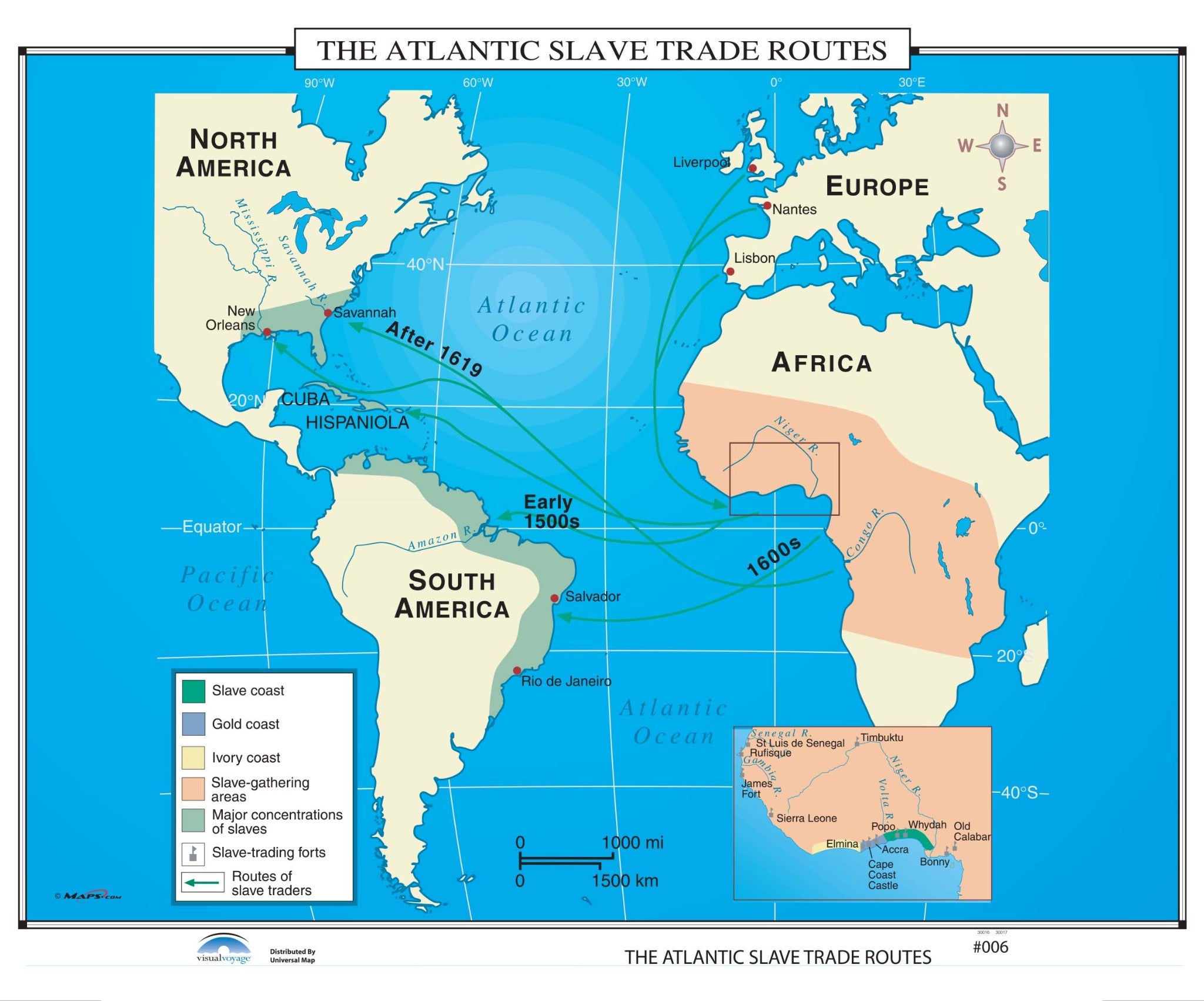
#006 The Atlantic Slave Trade Routes Geography_IN The NOAA Nautical Chart 13200:The shaded areas on The Atlantic Slave Trade Routes wall map identify the Slave, Gold, and Ivory Coasts; along with slave gathering areas, major concentrations of slaves, slave trading forts, and the routes of the slave traders.


US$ 225.00


US$ 49.99


US$ 39.99


US$ 39.99


Pay in 4 interest-free payments of $20.00 Learn more